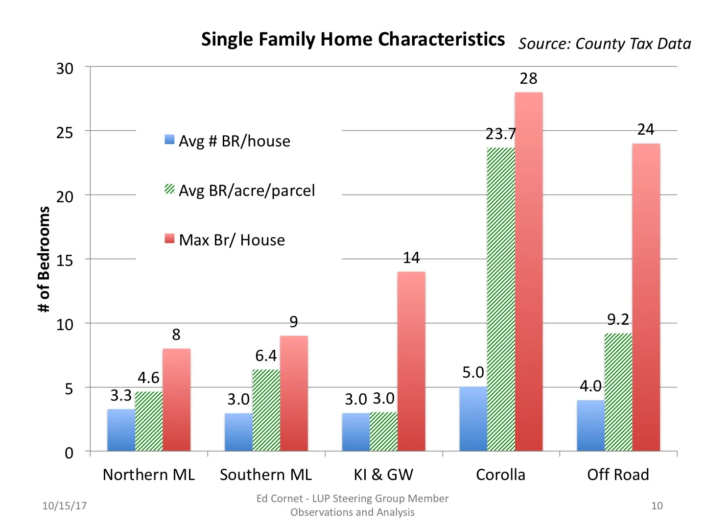
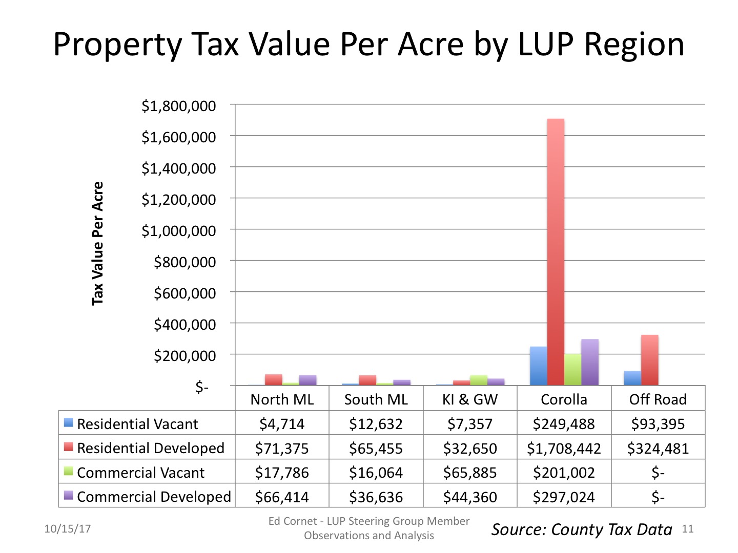
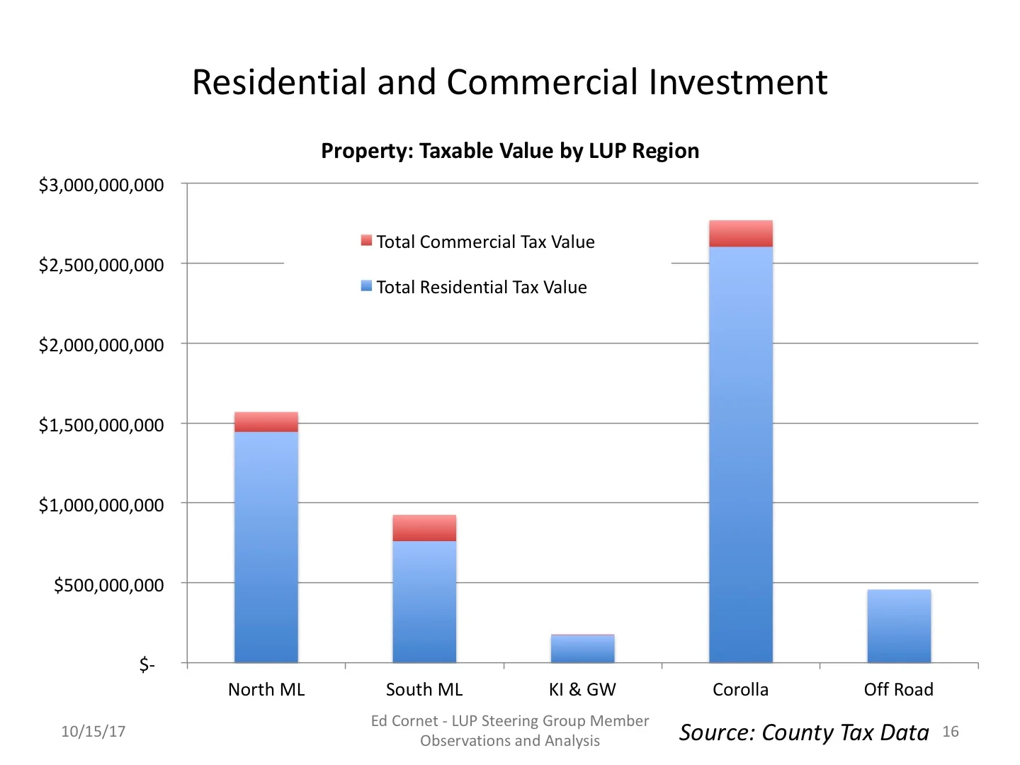
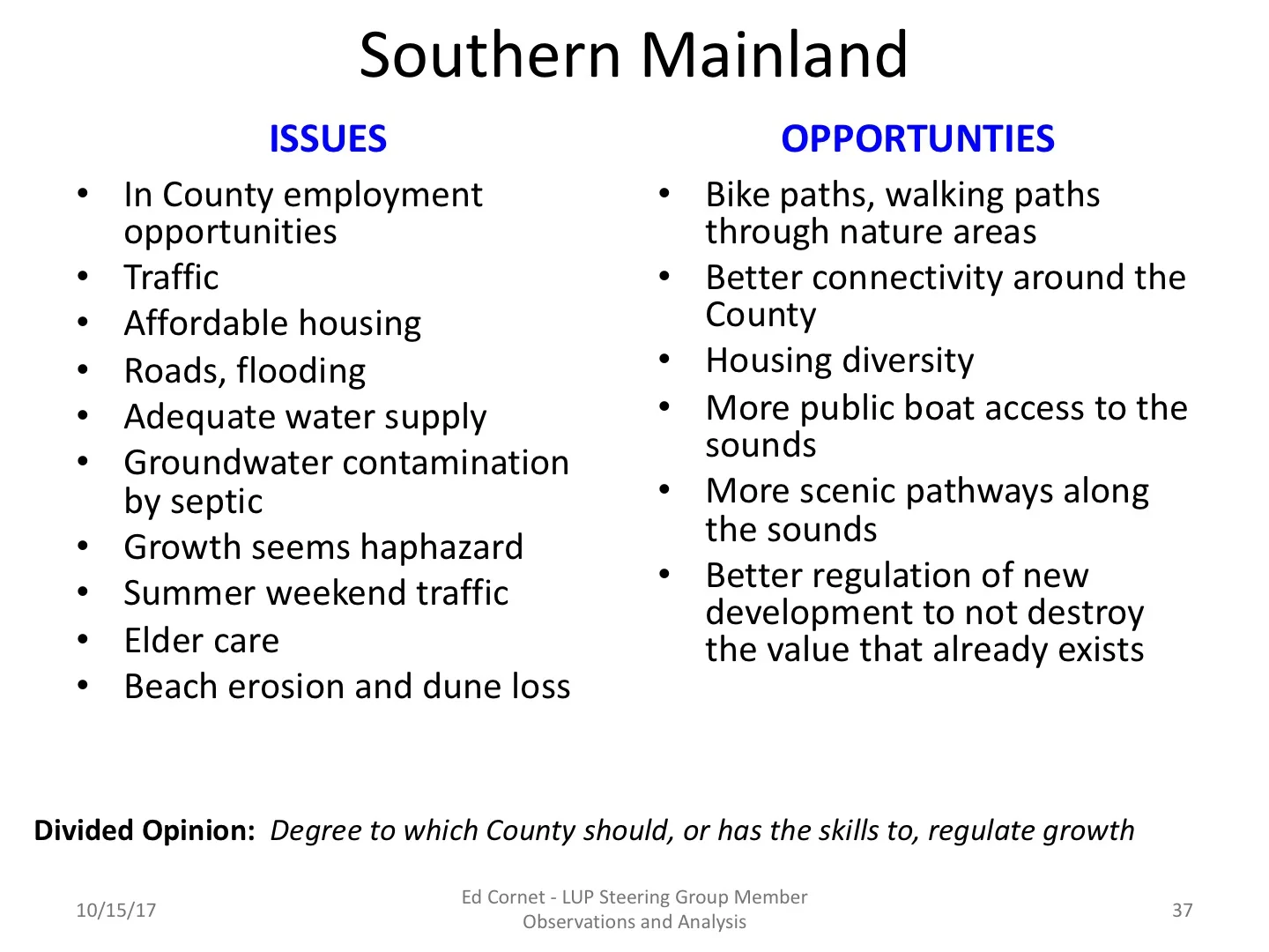
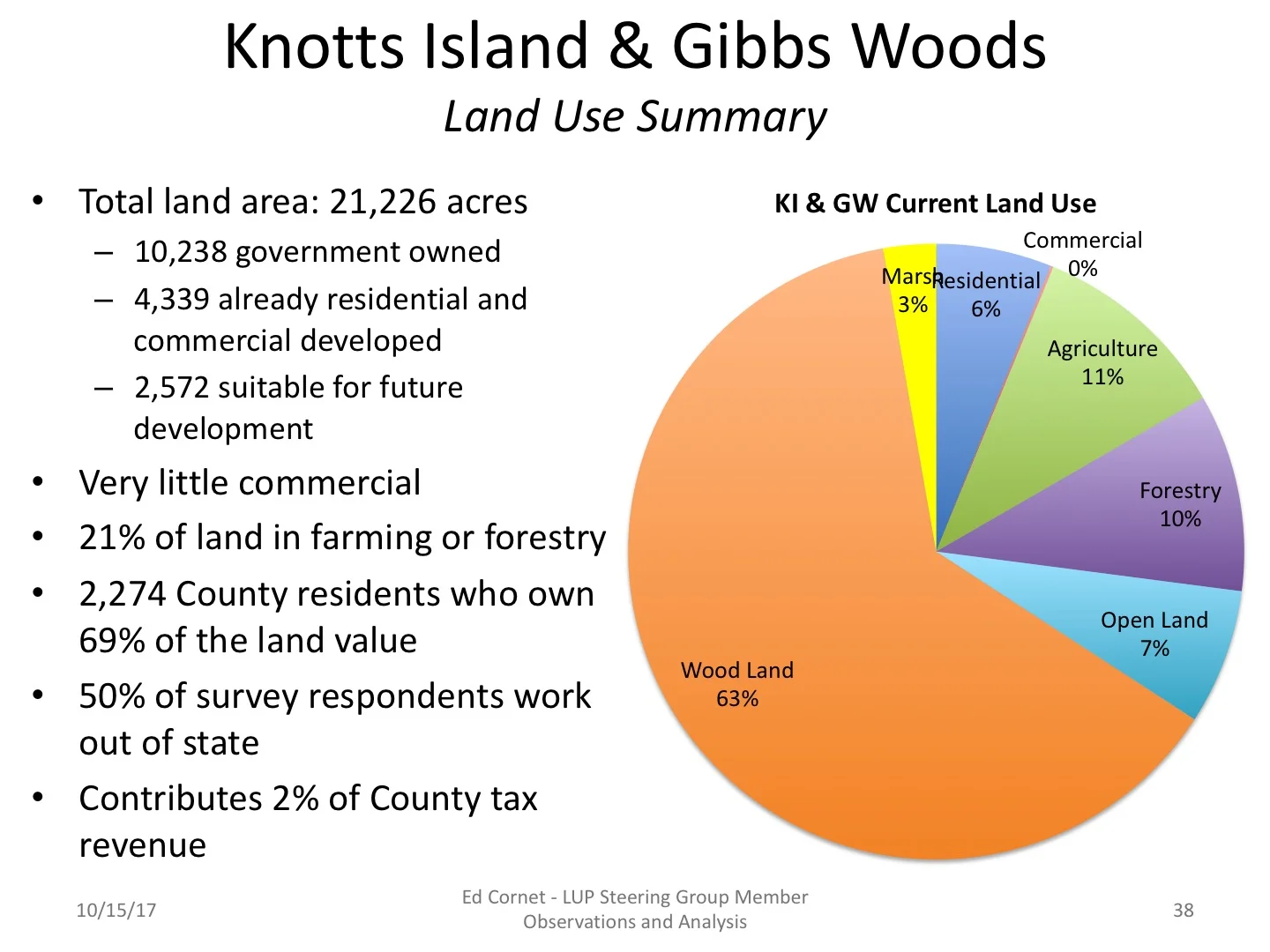
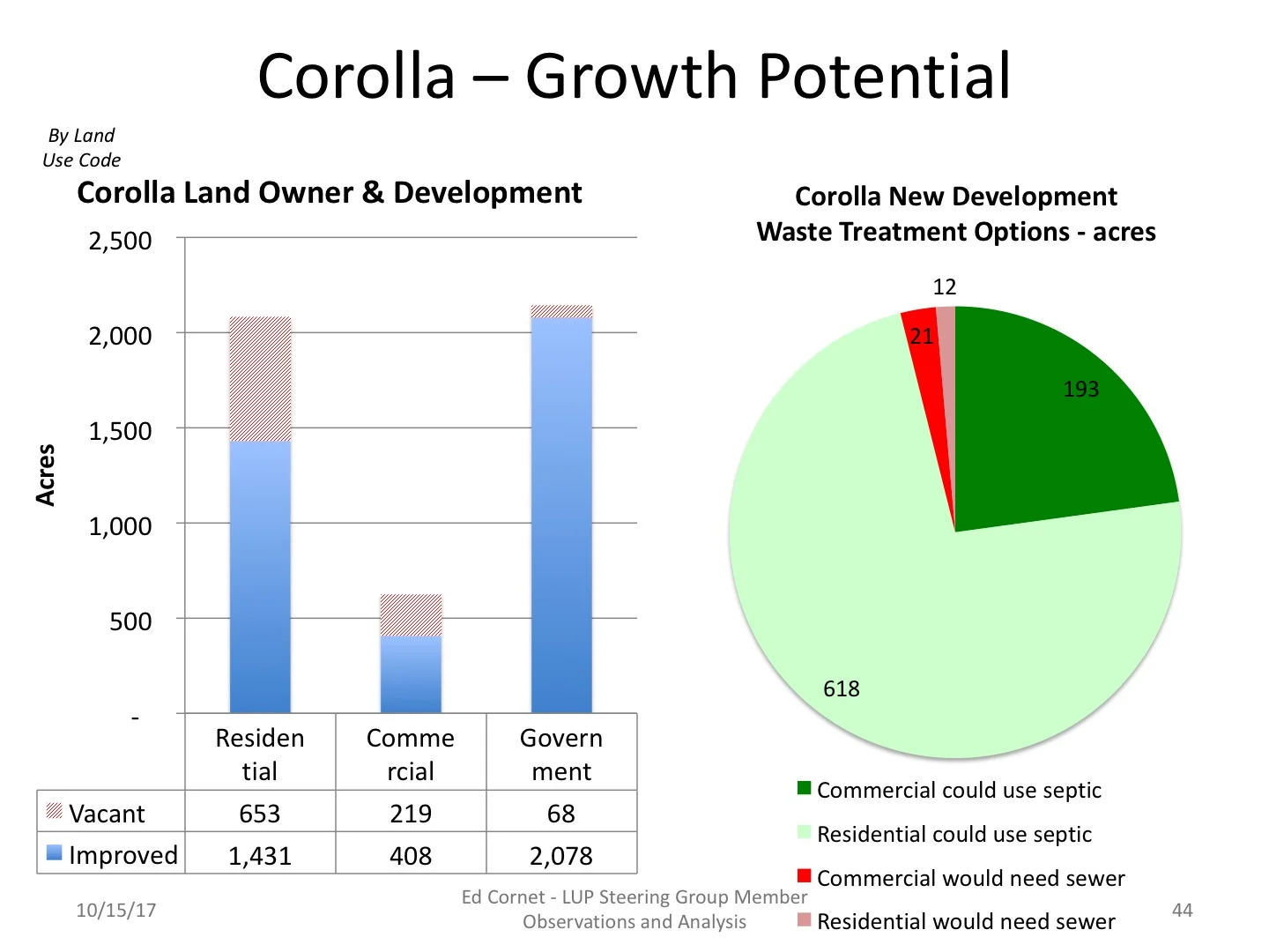
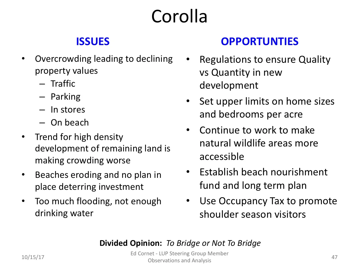
Click through the slideshow below to see a comparison of they attributes of the five major regions of land use, land type, residential, commercial and government development and other factors. Then there is a summary of each region.


Keeping Our Economy Strong
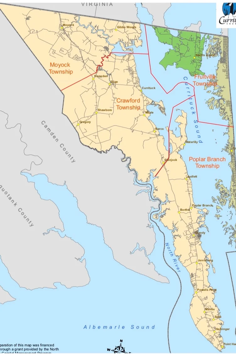
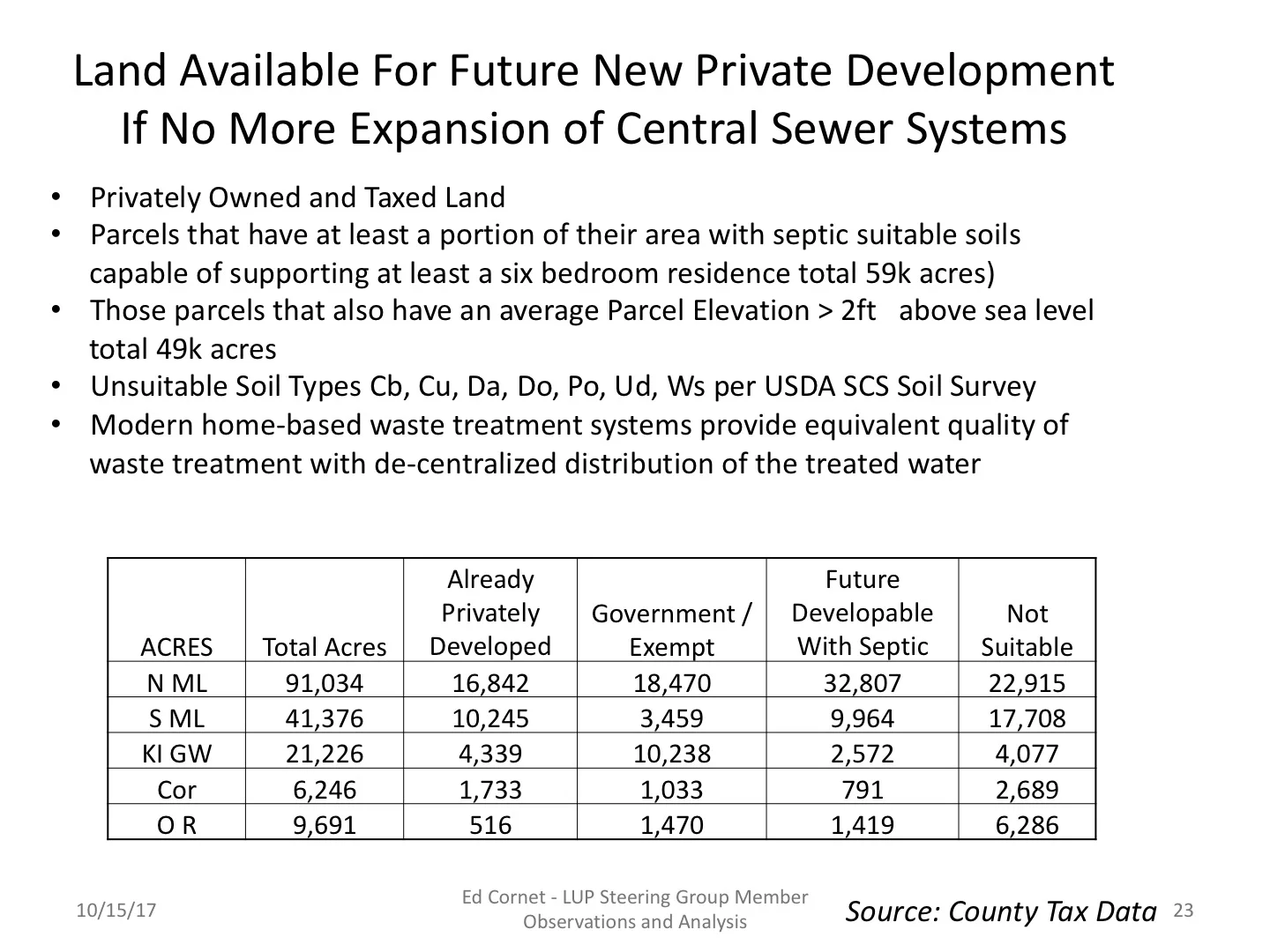
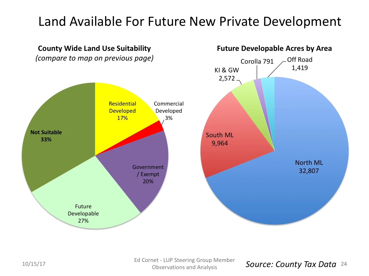
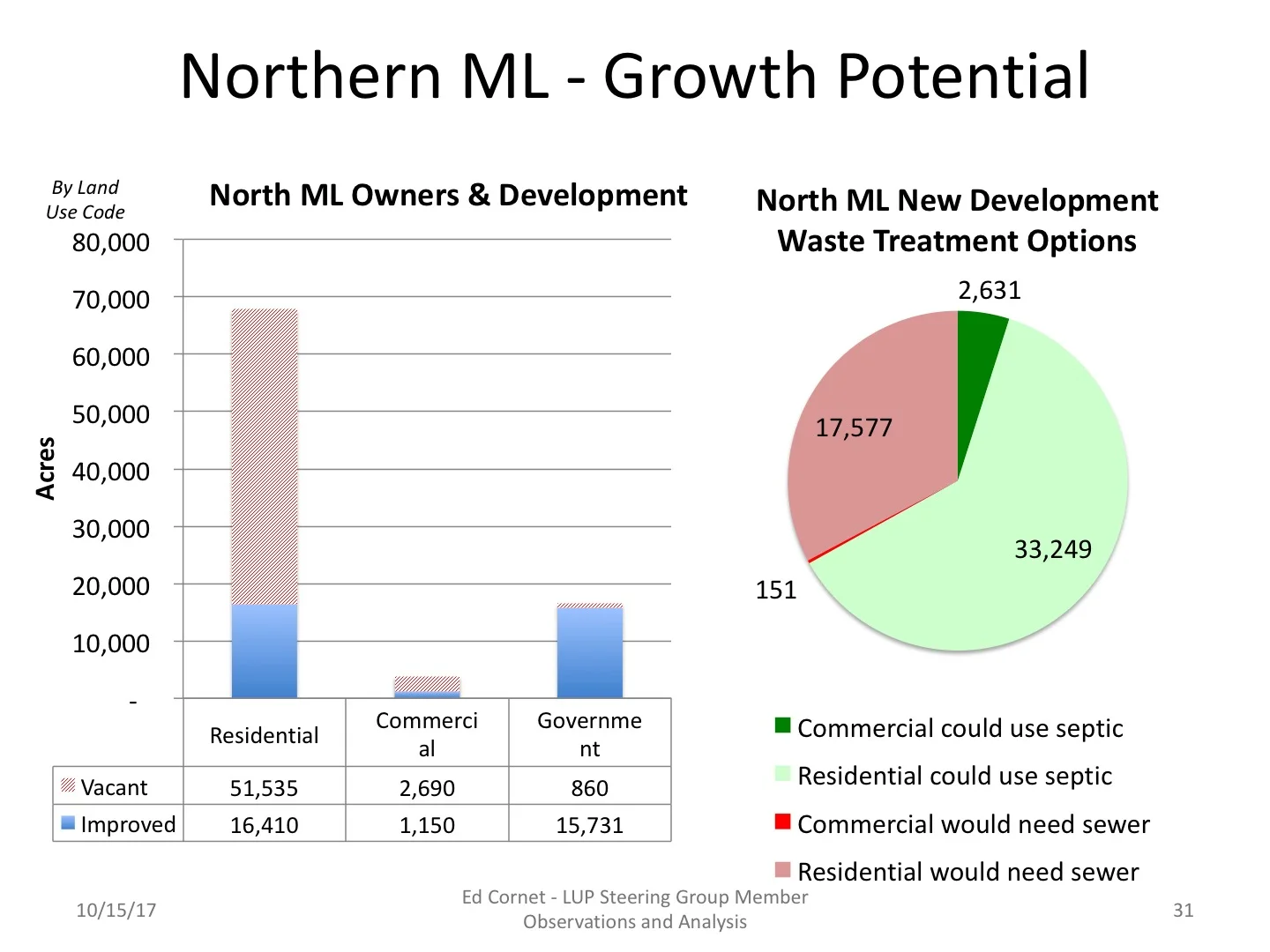
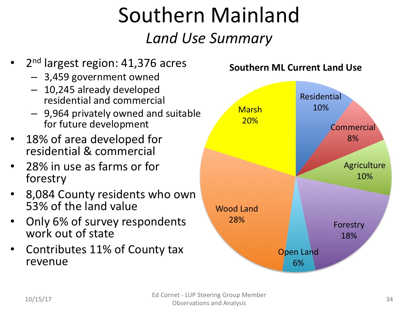
Currituck County maintains more than a hundred descriptive elements of each of the 25,000 parcels of land in the County in its tax databases. In addition the GIS databases contains information on land elevations, soil types and other features. I worked with Tax Department director Tracey Sample and GIS head Harry Lee to download the information for my analyses as presented to the Land Use Plan Steering Group, County management and BoC members.
Powered by Squarespace.